
During our first summer in Nidderdale (2012) we walked the Nidderdale Way, all 53 miles of it. Starting was easy as it goes past our house. It’s a nice walk with not a lot of steep uphill and we completed it in seven days. This was quite an achievement for me although nothing compared with Martin’s Land’s End to John O’Groats 1306-mile 82-day walk in 2004.
Spurred on by this I began to look at the Dales Way which goes from Ilkley in Wharfedale to Bowness-on-Windermere in the Lake District. Opinions vary about the total distance but 78 miles seems to be the received wisdom.
Go here for a picture gallery.
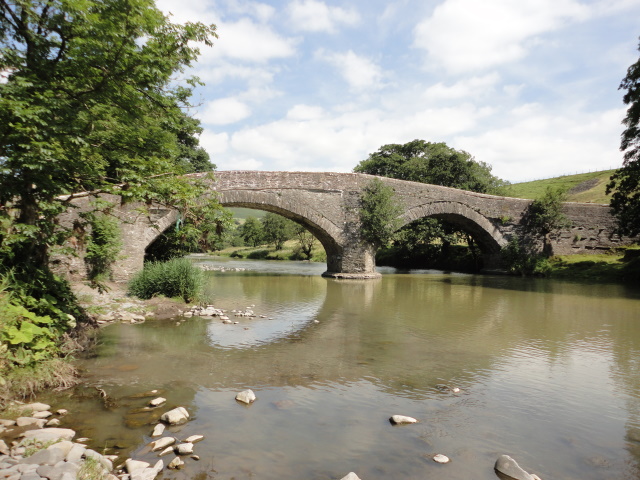
Beside the River Wharfe
So we started on 4 June 2013 walking from Ilkley to somewhere near the Strid in Bolton Abbey Woods then up to the road for the bus.
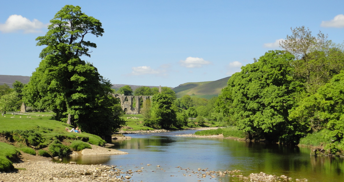
Wharfe at Bolton Abbey
Next day we parked at Grassington, took the bus back to where we stopped the day before and walked alongside the Wharfe to Grassington via a large chocolate cake tea in Burnsall. Five days later we parked at Grassington again and started the next leg which climbs up to the aptly named Coniston Pie where we ate our picnic. The route then drops down into Kettlewell and follows the river up to Buckden where there is a bus back to Grassington.
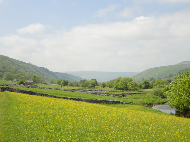
Buttercups near Kettlewell
This part of Wharfedale was not new territory for us as we had driven up it and walked some of it before, but it was really good to see the scenery from ground level at walking pace. It’s quintessential dales scenery with smallish fields and dry stone walls. There are plenty of sheep in this part of the world and the stiles between the fields have all been replaced by small gates which have a spring so that people can’t leave them open. These three days were easy and enjoyable walking, a gentle introduction for what was to come.
Meeting the Pennine Way and on to Ribblehead
We didn’t get going again until 13 September 2014. We parked at Skipton and took the bus to Buckden. Further up from there the Wharfe narrows through Hubberholme, Yockenthwaite, Deepdale and Beckermonds. Although still by the River Wharfe we were technically now in Langstrothdale. The road gets steeper as you climb to Outershaw at the beginning of a spectacular drive north over “the tops” to Hawes in Wensleydale. But we weren’t going to Wensleydale and we were at the point of no return to get back on a road for some time, let alone finding public transport. We turned north-west at Outershaw and climbed up over the moor.
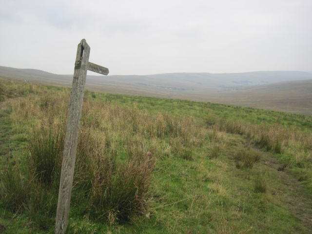
The Way to Cam Head
Eventually after three miles you reach the watershed at Cam Head. It’s bleak up there at 520m and the only landmark is where the Dales Way meets the Pennine Way. At another isolated house Gearstones we left the Dales Way and walked another 1.8 miles to Ribblehead (of the viaduct fame) to catch the train back to Skipton where we had a meal at one of our favourite Indian restaurants. This was a long day of 14 miles.

Track towards Ribblehead
After recovering from the 14-mile day, eight days later we drove to Dent Station which is the highest on a mainline railway in England and left the car there. It is 4.8 miles by road and 400m higher than the village of Dent. We took a 9-minute train ride to Ribblehead and walked back to the Dales Way and then down to Dent village. At one place you go under a very high railway viaduct and it’s a bit eerie looking up at it.

Dent viaduct
A volunteer-run Sunday only bus took us back to the car. We drove back home down Wensleydale, stopping for a meal in Hawes.
Dent and Around Sedbergh
On 27 September 2014 we left the car at Sedbergh and a bus ride took us back to Dent from where the Dales Way begins to wander a bit. We skirted Sedbergh passing the school and crossed plenty of fields to reach the bus stop at Lincoln’s Inn Bridge on the A684. Fortunately the storm clouds which loomed just after lunch by-passed us.
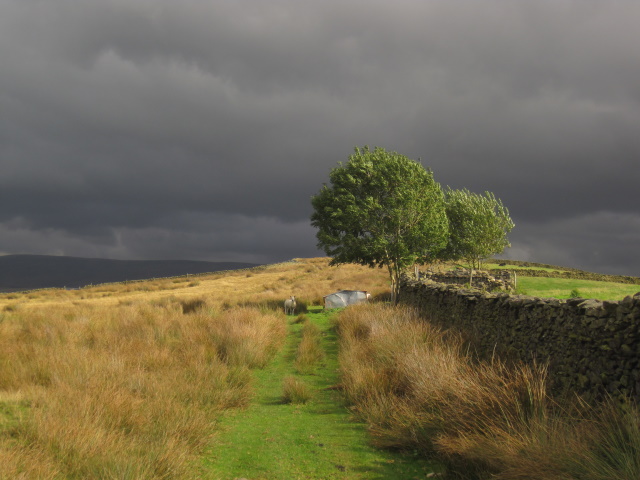
Storm coming near Sedbergh, but it missed us
We couldn’t leave Sedbergh without a stop in one of the bookshops there. It’s not quite Hay-on-Wye although Sedbergh describes itself as England’s Book Town. There were now 21.8 miles left to go.
North of Kendal
Things slowed down after that. In summer 2015 we went on a long road trip through Austria and Italy to Greece and Bulgaria which didn’t leave much time for walking. Much of summer 2016 was spent in planning our round the world trip to Malaysia, Australia, Samoa and Hawaii, but a week before we were due to leave in August 2016 we took a bus from Kendal back to Lincoln’s Inn Bridge. From there we were in unknown territory but alongside the River Lune.
Bridge over the Lune
After we left the river the scenery was to my mind a bit less attractive with the main landmarks being the M6 and the West Coast mainline railway, both of which now have good bridges. If you want to skip a day in doing the walk I suggest this one. We had planned to get to Burneside but this was perhaps the beginning of my hip problems as I just felt I couldn’t go any further when we reached the A685 south of Grayrigg. We called a taxi to get us back to the car.
Reaching Burneside After a 3-Year Gap
Almost all of 2017 was taken up with hip operations and recovery from them. The nearest we got to this part of the world in 2018 was a round-trip steam train excursion from Skipton to Carlisle on the Settle and Carlisle Railway. Finally in 2019 we drove to where we got the taxi in the middle of nowhere three years before and walked to Burneside from where we took a bus to Kendal, had some tea and took a rare bus which dropped us back by the car. There were nine miles to go but 2020 was out because of Covid and needing to stay the night for the last bit.
Burneside to Bowness
So we took the plunge in June 2021 and after a detailed examination of various weather forecasts, booked B&B at the Lyth Valley Country House west of Kendal for the night of 14 June. We had planned to drive to Staveley, the only village between Burneside and Bowness, and take the train to Burneside to start walking but traffic holdups meant we would miss the train we wanted to catch so we parked in Burneside instead.
Burneside is a pleasant Lakeland village but it’s dominated by various large buildings occupied by paper manufacturers James Cropper. Our walk started on a narrow path round 2.5 sides of this complex but soon we were alongside the River Kent and enjoyed a pleasant 3-mile walk with no hills. As we ate our picnic we saw a fish jump in the river. All was tranquil and we met just a few people. Mostly there were gates between the fields but there were two ladder stiles one of which had a nice handrail for those of us with small hands. We arrived in Staveley in good time for the 5-minute train ride back to Burneside on a clean and very punctual and empty Northern Rail train.
I had never visited the area south-east of Windermere town before. Our room at Lyth Valley was very spacious and clean and overlooked the valley which is wide, not like the dales. The scenery is mostly undulating with low round hills and a few sheep. We really needed our satnav to get us around through the narrow lanes which reminded me rather of Devon.
There was no dinner in the hotel and so after a nap we drove into Kendal, first to Sainsburys to pick up a picnic for the next day, then to get enormous helpings of fish and chips from Fish Express which we ate near a viewpoint on the way back to the hotel.

Yes the fish was longer than my boot
My fitbit recorded 14771 steps for the day, although I should note that it cheats a bit when we are driving on a bumpy road.
Apart from one night at the Holiday Inn Express in Bicester when we left our house in Oxford for the last time in November last year this was the first time we had spent a night away from our own house since the pandemic started. There were four other couples staying in the hotel, all young people. We kept our distance and were pleased that breakfast was served on a deck outside overlooking the valley. Overall it was a pleasant place to stay if you don’t mind dodgy wi-fi.
Then it was time to get psyched up for the real walking, six miles to Bowness with a lot of uphill first. We parked in Staveley and kept going uphill for almost an hour at first, after a brief conversation with a local who was tending to a nice grey horse. Sometimes we were on a narrow road, sometimes on a track. At the top the scenery spread out into grass with rocky outcrops and a few sheep. We ate our lunch sitting on a rock admiring the view of the mountains on the west side of Lake Windermere.

Lunch stop on the last day
It looked rather like Greece complete with sheep sitting under a tree. A few people overtook us including two guys who were doing the whole walk at once. They were on their last of seven days from Ilkley. Just after lunch we encountered the only cows of the two days and walked warily by the calves as their mothers looked on.
Once on the top there was more up and down but it was mostly quite gentle. Martin took a short side trip up School Knott from where you can see Windermere town and lake while I sat on a log. Going down to Bowness was easy. It’s a gentle walk with plenty of trees around. You come to the official end of the walk a bit above the village. There’s a stone seat and a small plaque saying it’s 81 miles to Ilkley. We were just getting ready to take some photos when a group of six young ladies arrived and sat down in front of us. They were not dressed for a long walk, but did eventually leave when we hinted that we really wanted to take some photos.

End of the Dales Way
Bowness and Ambleside to Home
It was less than ten minutes down to the lake at Bowness but what a contrast from the tranquility on the walk. Bowness was seething with unmasked people wandering around aimlessly or queuing for a lake cruise or just eating ice cream or drinking. We quickly took our photos standing among the Canada geese on the lake edge then looked for some tea.
The Belsfield Hotel is an imposing building a short way up on the hillside overlooking the lake. When I was a student I spent eight weeks in summer 1967 working there cleaning corridors and bathrooms. I had never been back. It’s now a Laura Ashley Hotel and has been done up for the luxury market. A menu by a little gate up to the hotel included a cream tea. We decided to celebrate finishing our walk by indulging.

View from the Belsfield
A table had just become empty and so we sat outside feeling a bit incongruous in our hiking gear. The tea was excellent with two large scones each and in the north of England they don’t care whether you put the cream or the jam on first.
The hordes had mostly vanished by the time we had finished our tea. We had a bit of time spare and so took the open top bus along the lakeside to Ambleside where we walked up to its most famous landmark, the house on the bridge. I remember it being a small souvenir shop but it was now closed, I suppose for safety reasons.
. 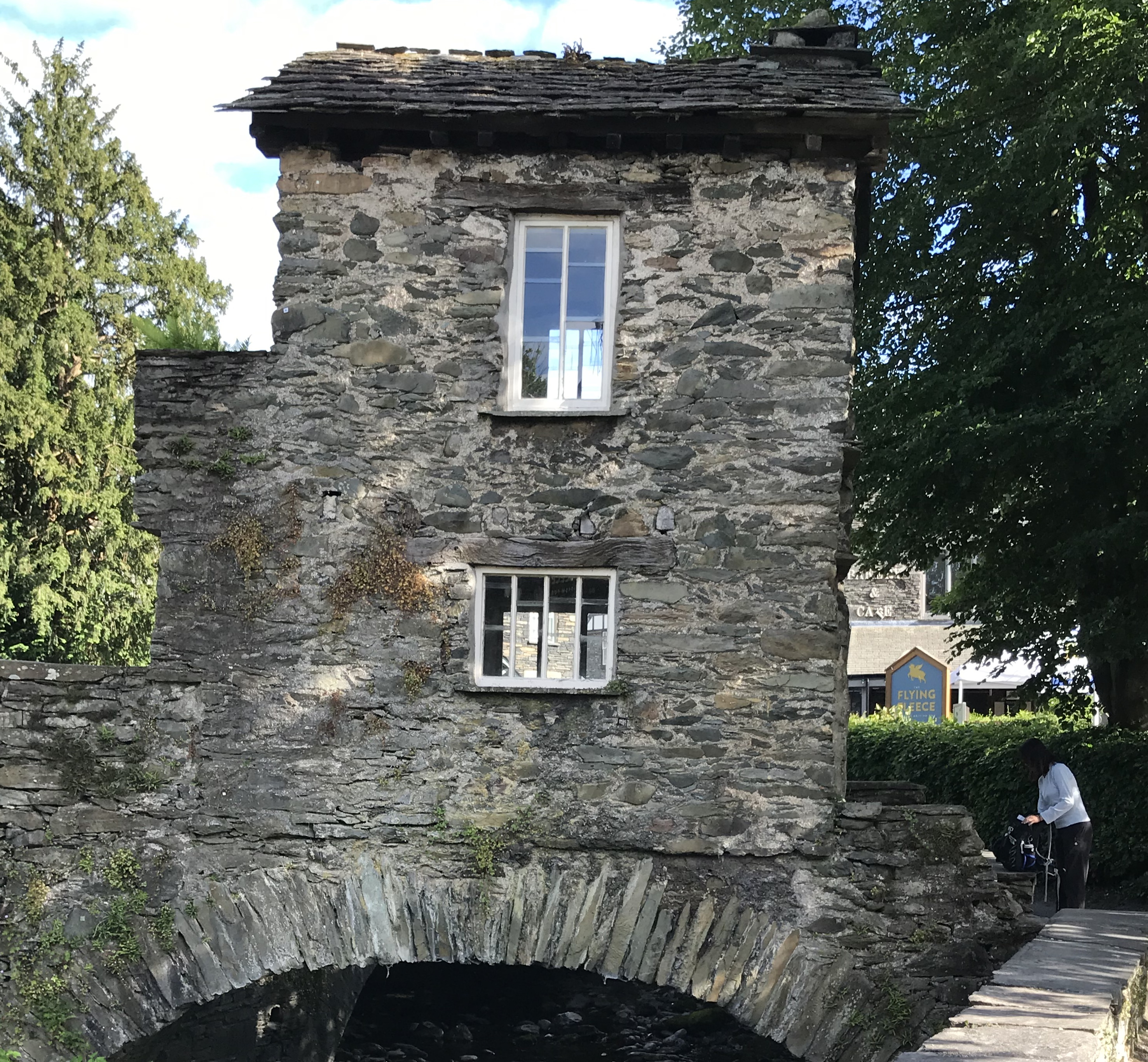
House on the Bridge, Ambleside
We took another bus back to Staveley, changed our footwear and headed again to Sainsburys to pick up a microwave meal for dinner and to get petrol.
There is a choice of routes to Kendal from Nidd Cottage. We decided to come home along Wensleydale rather than take the A65 via Skipton. The road was deserted and there were very few people sitting outside. Might it be because of a football match? We didn’t care as we made it to Nidd Cottage in 1 hour 53 minutes and were eating dinner within 20 minutes of getting home. My fitbit recorded 25813 steps for the day.
Practicalities
It’s almost impossible to get lost on the Dales Way. There are very frequent signs with the walk logo. An essential book for doing this walk is Dales Way The Complete Guide by Colin Speakman. The route is described in great detail with 24 maps each filling a page and covering between 2.5 and 3.5 miles of the walk. Landmarks are shown on the maps as are field boundaries, gates and the very few stiles. There are also detailed descriptions of each section and short pieces about items of local interest.
We also used the Harvey Long Distance Route Dales Way map which divides the walk into six sections with extras showing link routes from Leeds, Bradford and Harrogate. This map shows all the contours and so you know how many hills you are letting yourself in for.
The Wikipedia article on the Dales Way, recently updated by Martin, is another useful source of information with links to many of the villages on the route.
We proved that you can do it using public transport to get back to your car. All the timetables are online and every bus and train we needed turned up on time and had plenty of room. We met and chatted to several other walkers, mostly couples. Plenty of dogs, even small ones, were walking as well, but dog owners do need to be careful as there are a lot of sheep in this part of the world.
So now I have a real sense of achievement. Looking back I enjoyed all of it and for the last two days it was good to see new territory in perfect weather for walking.
Picture gallery: Our Dales Way Walk
Click to enlarge

Wharfe at Bolton Abbey 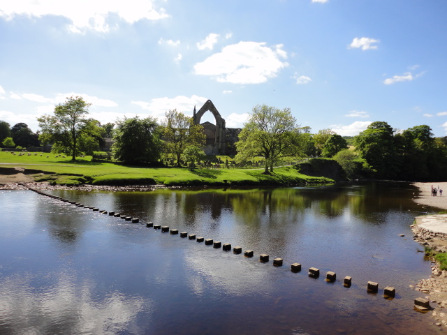
Stepping stones at Bolton Abbey 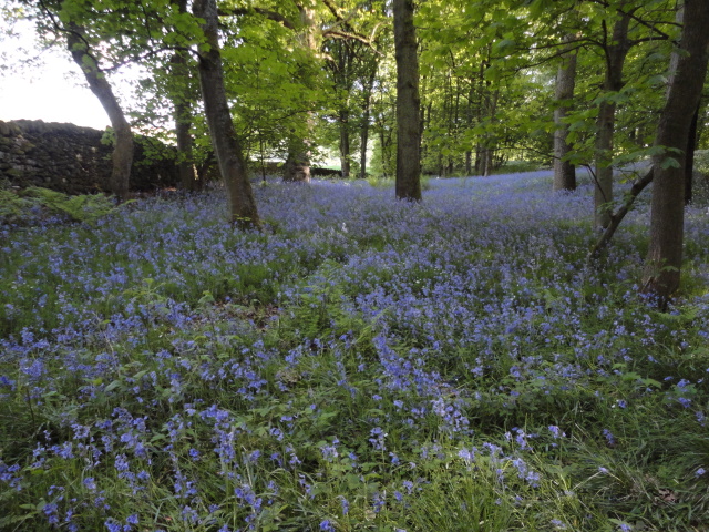
Bluebells in Bolton Woods 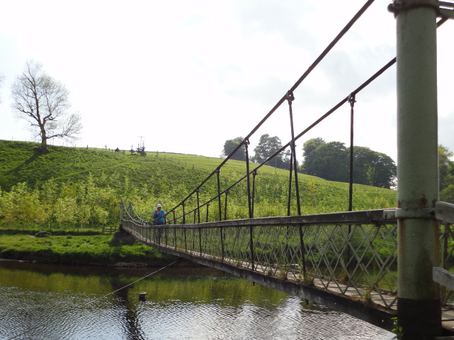
Crossing the Wharfe at Hebden 
Lambs near Grassington 
Buttercups near Kettlewell 
Langstrothdale 
The way to Cam Head 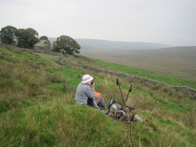
Chocolate stop on the way to Cam Head 
Ingleborough in the far distance 
Not an easy path towards Cam Head 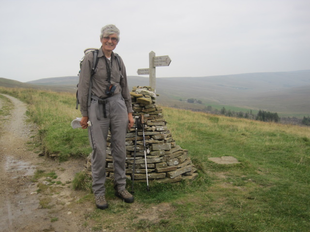
Meeting the Pennine Way 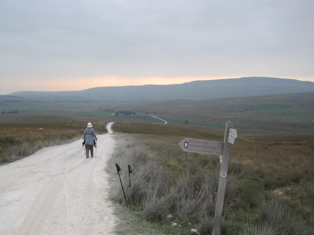
Track towards Ribblehead 
Dent viaduct 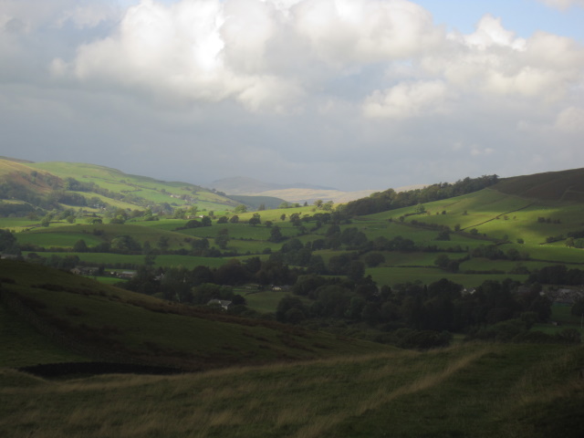
Near Sedbergh 
Storm coming near Sedbergh, but it missed us 
Bridge over the Lune 
Lunch stop on the last day 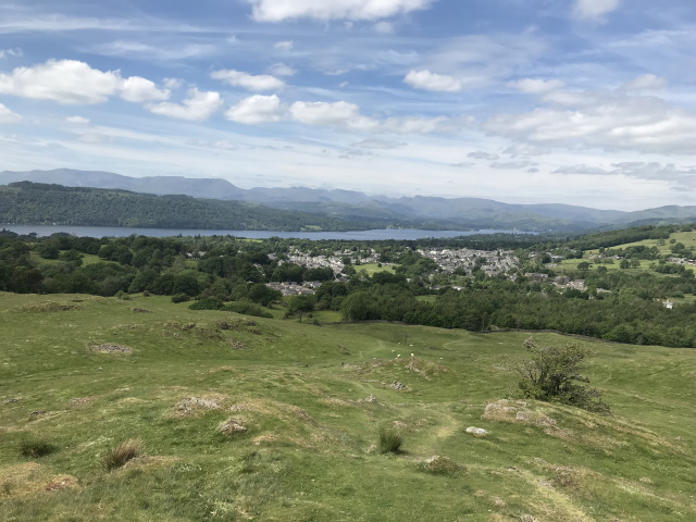
Windermere from School Knott 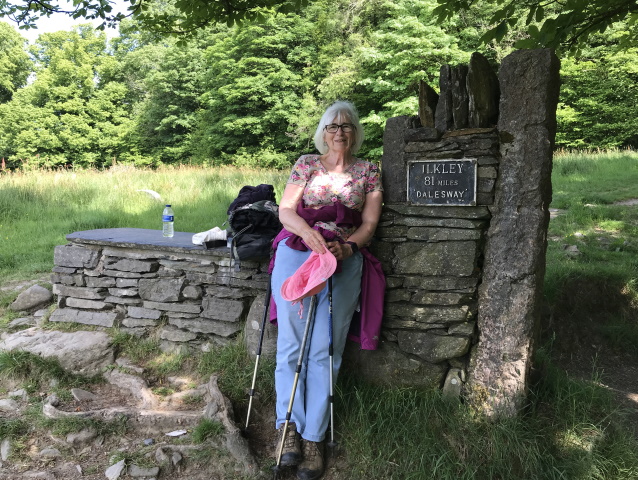
End of the Dales Way 
End of the Dales Way 
Belsfield Hotel 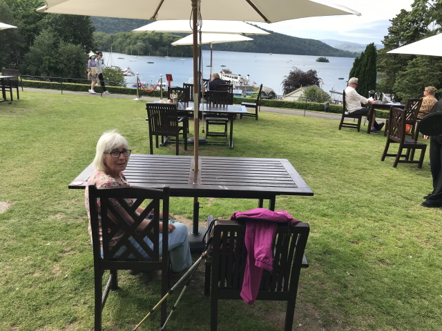
Terrace at the Belsfield 
View from the Belsfield Hotel 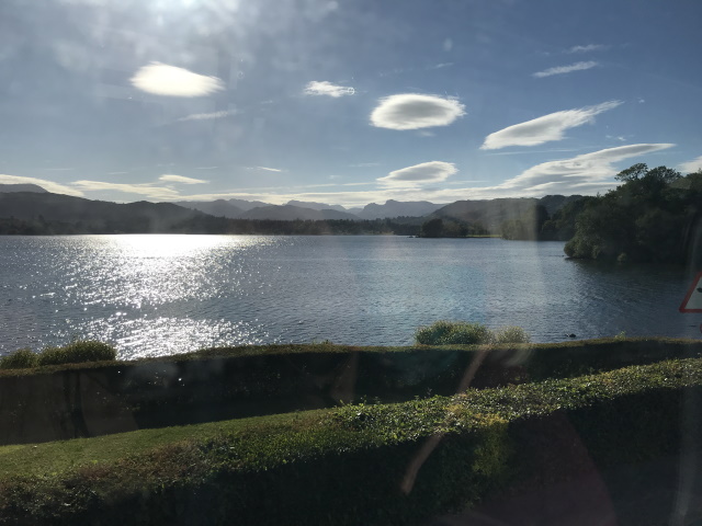
Windermere from the bus 
House on the Bridge, Ambleside 
Yes the fish was longer than my boot 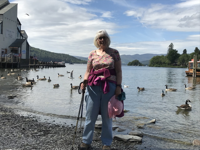
Lake Windermere 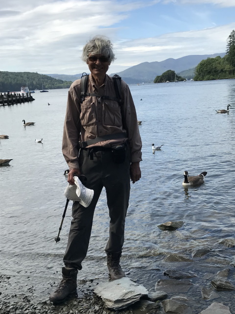
Lake Windermere
There are more posts on our travels here.
Note: The format of this post is a bit different from my earlier ones as WordPress no longer includes some of the functions I used.
